Restoring River Habitats: What’s Being Done in the U.S.
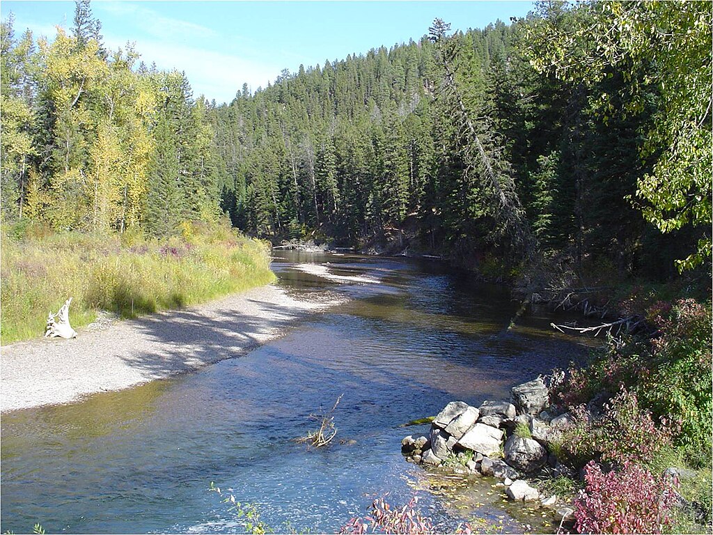
Rivers are the lifeblood of America’s landscapes, providing essential ecosystem services, supporting biodiversity, and connecting communities. Yet decades of development, pollution, and mismanagement have left many U.S. waterways degraded and dysfunctional.
Today, a remarkable transformation is underway as scientists, government agencies, non-profits, and communities join forces to restore these vital aquatic corridors. From the removal of obsolete dams to the reintroduction of native species, river restoration has evolved into a sophisticated science with proven approaches and inspiring success stories.
This article explores the comprehensive efforts being undertaken across the United States to bring our rivers back to life, examining the techniques, challenges, and promising outcomes of this critical environmental movement.
The Historical Degradation of America’s Rivers
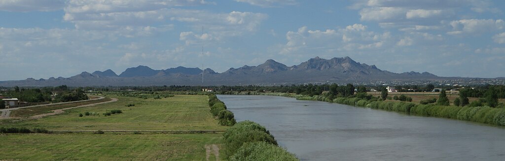
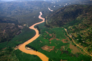
The story of America’s rivers is inextricably linked to the nation’s development, with waterways serving as transportation corridors, power sources, and waste disposal systems during the country’s industrial expansion. By the mid-20th century, many rivers had been dammed, channelized, polluted with industrial waste, and disconnected from their floodplains, resulting in severe habitat loss and degradation.
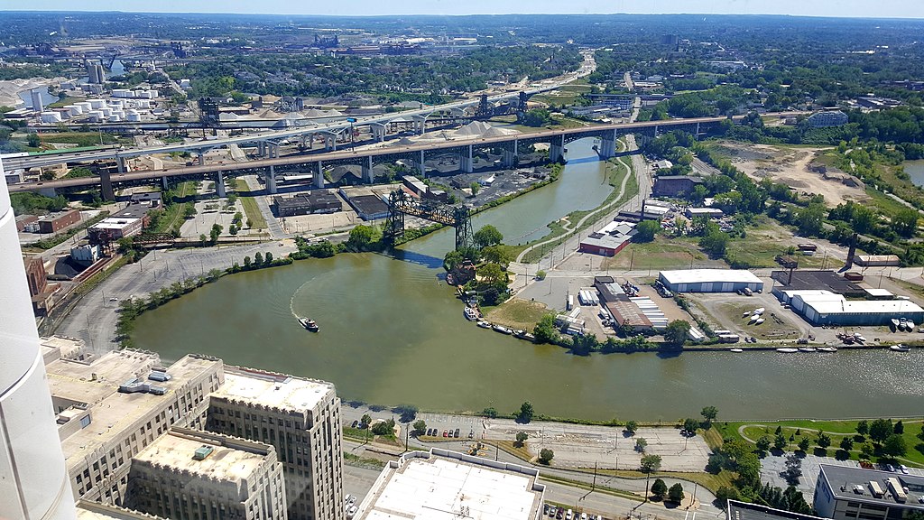
The Cuyahoga River in Ohio became emblematic of this crisis when it infamously caught fire in 1969 due to extreme pollution, helping catalyze the modern environmental movement and legislation like the Clean Water Act. Throughout the country, native fish populations crashed, water quality plummeted, and the ecological functions of rivers were severely compromised.
This historical context provides crucial background for understanding the scope and importance of today’s restoration efforts, which seek to reverse centuries of damage while balancing contemporary human needs.
Dam Removal: Reconnecting River Systems

Dam removal has emerged as one of the most dramatic and effective approaches to river restoration across the United States. With approximately 90,000 dams nationwide, many built decades ago for purposes now obsolete or inefficient, these structures fragment river ecosystems and block migratory fish pathways.
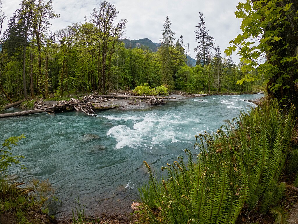
The Elwha River restoration in Washington State stands as a landmark project, where the removal of two large dams between 2011 and 2014 represented the largest dam removal in U.S. history, freeing 70 miles of habitat and allowing the return of all five native salmon species. On the East Coast, the removal of Maine’s Edwards Dam on the Kennebec River in 1999 marked a turning point, demonstrating that dam removal could benefit ecosystems without economic harm.
The pace of dam removal has accelerated, with more than 1,900 dams removed nationwide since 1912, and organizations like American Rivers helping communities assess aging infrastructure and implement removal projects that reconnect river systems and restore natural flow regimes.
Floodplain Reconnection and Restoration
Floodplains are the low-lying areas adjacent to rivers that naturally flood during high water. They are receiving renewed attention as critical components of healthy river ecosystems. Historically, these areas were disconnected from rivers by levees and development, eliminating crucial habitat and natural flood control.
Modern restoration projects are now deliberately reconnecting rivers to their floodplains. This allows seasonal inundation that creates diverse aquatic habitats, recharges groundwater, and provides natural flood protection. The Cosumnes River Preserve in California exemplifies this approach, where intentional levee breaches have restored natural flooding patterns across 46,000 acres. It has created vital wetland habitat for migratory birds and native fish.
In the Upper Mississippi River basin, the U.S. Army Corps of Engineers works with state agencies on the Upper Mississippi River Restoration program. They have already completed more than 55 floodplain restoration projects. These efforts recognize that healthy rivers require space to flow. They also recognize that functioning floodplains provide ecosystem services worth billions of dollars in water filtration, flood mitigation, and habitat provision.
Stream Channel Reconstruction
Stream channel reconstruction involves physically reshaping damaged waterways to restore natural morphology and function. This technique addresses rivers that have been straightened, deepened, or otherwise altered for flood control or development purposes.
Using principles of natural channel design, restoration practitioners recreate meanders, riffles, pools, and other features that provide habitat diversity and improve ecological function. In urban areas like Baxter Creek in El Cerrito, California, concrete channels have been removed and replaced with naturalized streambeds featuring native vegetation and varied flow patterns.
The Kissimmee River Restoration Project in Florida represents one of the largest channel reconstruction efforts, restoring 40 miles of river and 44 square miles of floodplain that had been channelized into a straight canal. Engineers and ecologists now employ sophisticated modeling techniques to design channels that can accommodate flood flows while providing ecological benefits. They often incorporate large woody debris, boulders, and other structural elements that create habitat complexity and slow erosive flows.
Riparian Buffer Restoration
Riparian buffers are the vegetated zones alongside waterways. They serve as critical transition areas between aquatic and terrestrial environments, providing numerous ecological benefits. These natural buffers filter pollutants, stabilize banks, moderate water temperatures with shade, and supply food and habitat for aquatic organisms. Across the country, restoration programs are replanting native trees, shrubs, and grasses along denuded riverbanks to reestablish these vital zones.
The Chesapeake Bay Program has made riparian restoration a centerpiece of its watershed improvement efforts. States like Pennsylvania are establishing buffer programs that offer incentives to landowners who plant and maintain streamside forests. The Conservation Reserve Enhancement Program (CREP), administered by the USDA, provides financial assistance to farmers. They are farmers who convert cropland adjacent to waterways into vegetated buffers, creating a win-win for water quality and wildlife.
Moreover, research consistently demonstrates that healthy riparian corridors of at least 100 feet in width can significantly reduce nutrient and sediment pollution. At the same time, they provide migration corridors for wildlife and increasing resilience to climate change impacts.
Fish Passage Construction
For dams that cannot be removed due to their importance for water supply, flood control, or hydropower, fish passage structures provide an alternative approach to reconnecting fragmented river habitats. These engineered solutions include fish ladders, bypass channels, elevators, and other devices designed to help migratory species navigate around barriers.
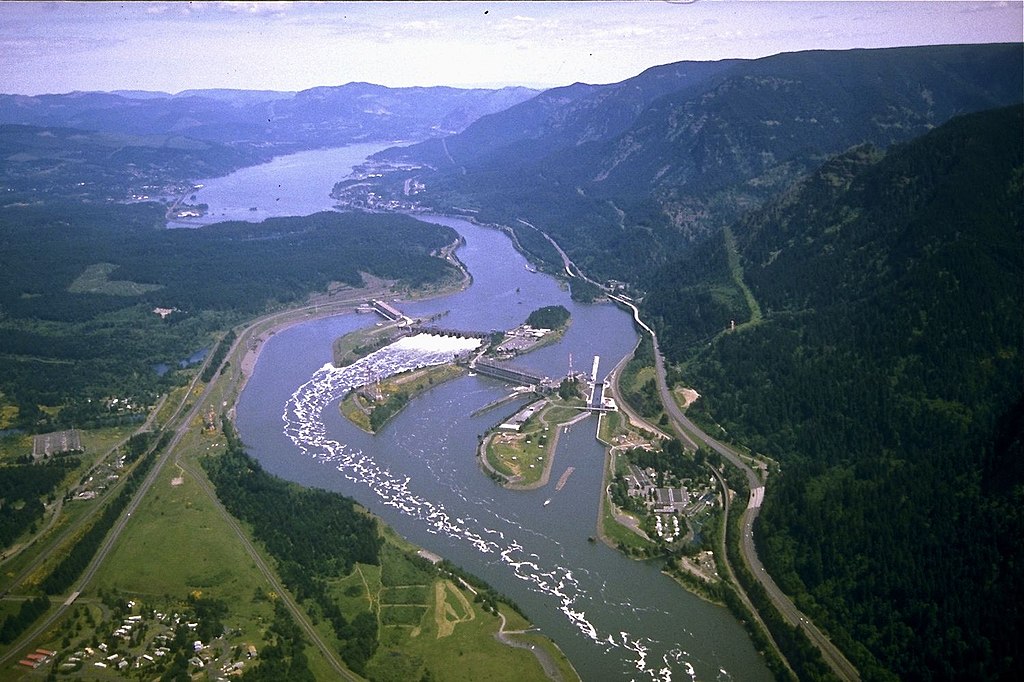
The Columbia River basin has been a focus of massive fish passage investments. It has facilities like those at Bonneville Dam allowing salmon to ascend fish ladders while viewing windows enable scientists and the public to monitor migration. In New England, the Penobscot River Restoration Project took an innovative approach. Moreover, it removed two dams and built a state-of-the-art fish bypass around a third, opening nearly 2,000 miles of habitat while maintaining hydropower generation.
Beyond structures for upstream migration, technologies like fish-friendly turbines and downstream bypass systems help young fish survive their journey to the ocean. Advanced monitoring using PIT tags (Passive Integrated Transponders) allows scientists to track individual fish movements through these passages, enabling ongoing refinements to improve effectiveness for multiple species.
Water Quality Improvement Initiatives
Enhancing water quality remains fundamental to river restoration, building on the regulatory framework established by the Clean Water Act. Contemporary approaches combine point source pollution control with innovative strategies to address non-point runoff from agricultural lands, urban areas, and other diffuse sources.
Green infrastructure projects in cities like Philadelphia and Portland use bioswales, rain gardens, and permeable pavements. They capture and filter stormwater before it enters waterways, reducing both pollution and flood risks. In agricultural regions, precision farming techniques and conservation practices, such as cover crops and no-till farming, help minimize nutrient and sediment runoff. Meanwhile, constructed wetlands provide natural water filtration.
The EPA’s Total Maximum Daily Load (TMDL) program establishes pollution budgets for impaired waters, driving collaborative watershed-based restoration plans. In the Delaware River basin, water quality improvements have been so successful that the river now supports the largest spawning population of American shad on the Atlantic coast. As a result, bald eagles have returned to nest along its banks—powerful indicators of an ecosystem recovering from centuries of industrial pollution.
Reintroduction of Native Species
The return of native species serves as both a goal and a measure of successful river restoration. There are numerous projects focused on reestablishing indigenous fish, mussels, and other aquatic organisms. In the Southeast, the Conservation Fisheries organization operates specialized hatcheries that breed rare and endangered fish species for reintroduction to restored habitats. They help recover populations of creatures like the Citico darter and smoky madtom.
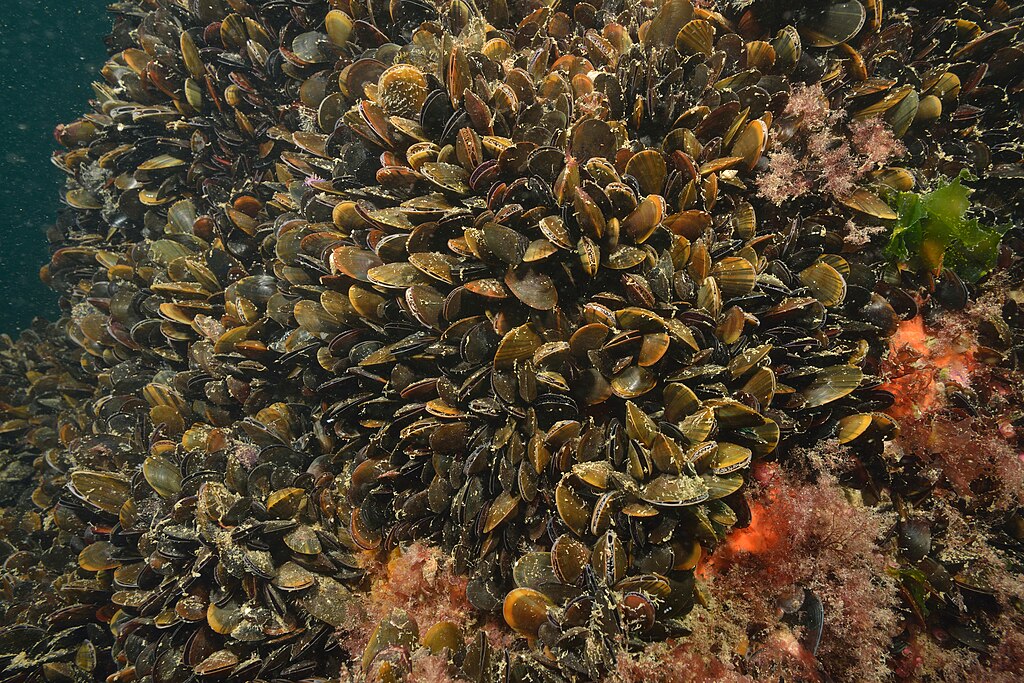
The Freshwater Mollusk Conservation Center at Virginia Tech leads efforts to propagate endangered mussels. Mussels are filter-feeders that improve water quality while serving as indicators of ecosystem health. California’s Clear Creek has seen remarkable returns of Chinook salmon following a multi-faceted restoration. It included gravel augmentation, dam removal, and reconnecting the floodplain.
These reintroduction efforts often require painstaking research to understand the species’ requirements and careful monitoring to track their success. Genetic management is also becoming increasingly important to maintain diversity in recovering populations. Beyond individual species, restoration ecologists now focus on reestablishing community assemblages and food web relationships that support ecosystem resilience.
Innovative Funding Mechanisms
The scale of river restoration across America has necessitated creative approaches to funding. They are moving beyond traditional government appropriations to diverse financial instruments. Environmental impact bonds represent one innovative mechanism. DC Water is pioneering a $25 million bond for green infrastructure that ties investor returns to environmental performance metrics.
Water funds, like The Nature Conservancy’s Rio Grande Water Fund in New Mexico, pool investments from multiple stakeholders. The goal is to finance upstream watershed restoration that protects downstream water supplies. The National Fish and Wildlife Foundation leverages public conservation dollars with private matching funds. They are generating substantial resources for river projects through their various grant programs.
In the Pacific Northwest, the Columbia Basin Water Transactions Program uses market-based approaches. Their goal is to keep water in streams during critical low-flow periods, benefiting fish while compensating water rights holders. These diverse funding approaches recognize that healthy rivers provide quantifiable economic benefits. They include improved water supply, reduced flood damage, increased recreation, and enhanced property values. These benefits often far outweigh restoration costs.
Community Engagement and Citizen Science
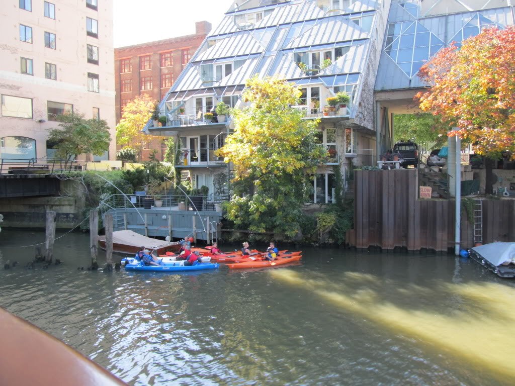
Successful river restoration increasingly depends on engaging local communities as advocates, stewards, and participants in the restoration process. Organizations like River Network connect and support more than 2,000 local watershed groups nationwide. They also provide resources and training for community-based restoration.
Urban Rivers in Chicago exemplifies innovative community engagement through its “Wild Mile” project. They create floating gardens and habitats while involving residents in design, installation, and monitoring. Additionally, citizen science programs enable volunteers to collect valuable data on water quality, wildlife, and habitat conditions. The Izaak Walton League’s Save Our Streams program, for instance, trains citizens in standardized monitoring protocols. They produce scientifically valid data that regulatory agencies use.
The Anacostia Watershed Society in Washington, D.C. combines restoration work with environmental education. They are creating a new generation of river stewards through their Saturday Environmental Academy for urban youth. These community-based approaches recognize that sustainable river restoration requires not just ecological recovery but also rebuilding human connections to waterways and cultivating local capacity for long-term stewardship.
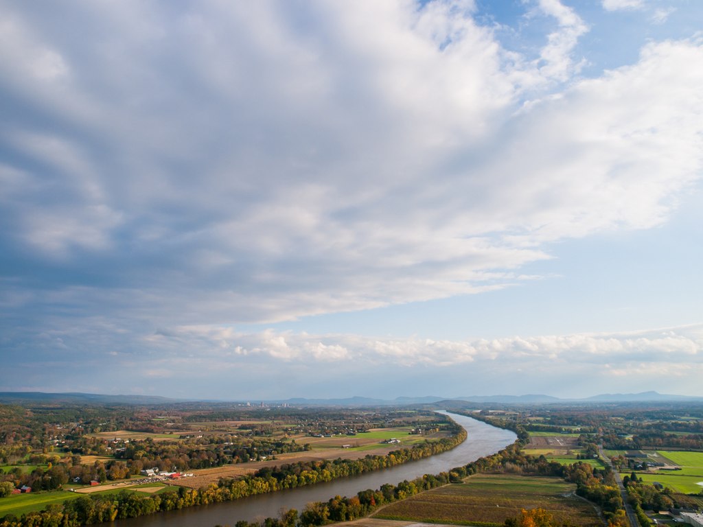
Watershed-Scale Planning and Management
Modern river restoration increasingly adopts watershed-scale approaches that address entire drainage systems rather than isolated stream segments. This holistic perspective recognizes that rivers are products of their watersheds. Furthermore, their conditions are influenced by land use practices throughout the basin. The Delaware River Watershed Initiative exemplifies this approach, coordinating conservation work across four states, multiple jurisdictions, and diverse landscapes to protect and restore water quality.
In the Chesapeake Bay watershed, the nation’s largest estuary restoration effort integrates actions across 64,000 square miles and six states through a formal multi-state compact with specific, measurable goals. Geographic Information Systems (GIS) and sophisticated modeling tools now enable planners to identify critical areas for protection and restoration. Through these tools, they can now prioritize interventions for maximum ecological benefit.
Adaptive management frameworks allow restoration practitioners to learn from outcomes, adjust strategies, and respond to changing conditions. These are essential for long-term success in dynamic natural systems. This watershed perspective helps ensure that downstream restoration isn’t undermined by continued upstream degradation, creating more sustainable outcomes.
Climate Resilience in Restoration Design
Climate change has become an inescapable consideration in river restoration, with projects increasingly designed to enhance resilience to more extreme weather patterns. Restoration practitioners now incorporate climate projections into their planning. They are anticipating shifts in precipitation, temperature, and flow regimes that will affect restored systems.
The Connecticut River Watershed Council’s dam removal projects consider not just historical flow patterns but future flood scenarios. They also ensure fish passage works under changing conditions. In drought-prone regions, restoration often focuses on enhancing groundwater recharge and creating thermal refuges. They are deeper, cooler water areas where fish can survive during heat waves.
The Blackfoot River in Montana exemplifies climate-smart restoration. They have projects that improve streamside shade, enhance floodplain water storage, and reconnect groundwater systems to maintain coldwater habitat for trout despite warming trends. Restoring natural processes like sediment transport and floodplain connectivity inherently builds resilience. They are allowing river systems to adjust to changing conditions.
These approaches recognize that while we cannot precisely predict future conditions, we can create systems with the functional diversity and self-adjusting capacity to withstand change.
Measuring Success: Monitoring and Adaptive Management
Rigorous monitoring forms the backbone of effective river restoration, providing data to evaluate outcomes, refine techniques, and build scientific understanding. Modern restoration projects typically include comprehensive monitoring plans that track physical, chemical, and biological parameters before and after implementation.
The National River Restoration Science Synthesis cataloged over 37,000 restoration projects nationwide, finding that only 10% included adequate monitoring. It is a gap that the field is working to address through standardized protocols and dedicated funding. Advanced technologies like environmental DNA (eDNA) sampling can detect the presence of rare species from water samples. At the same time, drone surveys and LiDAR mapping provide detailed physical habitat assessments.
The Chesapeake Bay Program maintains one of the most sophisticated monitoring networks in the world. It tracks everything from water quality to submerged vegetation to blue crab populations, with data informing adaptive management decisions.
Beyond scientific metrics, practitioners increasingly incorporate social and economic indicators of success. They recognize that community benefits like improved recreation access and reduced flood damage are equally important outcomes of river restoration.
Future Directions in River Restoration
The field of river restoration continues to evolve, with emerging approaches promising even more effective recovery of aquatic ecosystems. Process-based restoration represents a paradigm shift from engineering fixed solutions toward reestablishing natural processes. They allow rivers to maintain their dynamic equilibrium over time. Reconciliation ecology explores how we can design urban and agricultural landscapes that integrate human uses with ecological function. This involves creating novel ecosystems that support biodiversity.
The “making room for rivers” concept, pioneered in the Netherlands and gaining traction in America. They reimagine floodplain management by designating areas where rivers can safely flood rather than constraining them between ever-higher levees. New restoration techniques like beaver dam analogues and post-assisted log structures mimic natural features to jump-start habitat recovery at low cost. As climate change intensifies, restoration will increasingly focus on creating resilient systems and maintaining ecological function under uncertain conditions.
The integration of Indigenous knowledge with western science offers powerful opportunities to incorporate traditional river management practices that sustained healthy ecosystems for millennia before European settlement.
Conclusion
River restoration in the United States represents one of the most ambitious environmental recovery efforts ever undertaken. They are seeking to heal waterways that support both ecological health and human communities. From the removal of obsolete dams to the reintroduction of native species, these projects demonstrate that damaged ecosystems can recover when given the opportunity.
The evolution from small, isolated projects to watershed-scale initiatives reflects growing understanding of river systems as interconnected networks requiring comprehensive approaches. While challenges remain—including climate change impacts, funding limitations, and competing water demands—the field continues to advance through innovation, collaboration, and adaptive learning.
As restored rivers once again flow freely, filter water naturally, provide wildlife habitat, and offer places for human connection with nature, they demonstrate the remarkable resilience of natural systems and the power of deliberate restoration efforts to reverse even severe environmental degradation.


Post Comment